Your Mobile Support

  • Subscribe to our RSS feed.
  • Twitter
  • StumbleUpon
  • Reddit
  • Facebook
  • Digg

Friday, 24 February 2012

Follow in Darwin's footsteps with the iNaturalist mobile app

Posted on 07:45 by Unknown

Editor’s Note: Today’s guest author is Dr. Scott Loarie, a fellow at the Carnegie Institution for Science at Stanford and co-director of iNaturalist.org, a biodiversity citizen-science website. Pepperwood Preserve was the recipient of a Google Earth Outreach Developer Grant, funded through the Google Inc. Charitable Giving Fund at the Tides Foundation. We’re excited to share how the iNaturalist Android application developed as a result of this grant is being used in action at Pepperwood Preserve.

Last weekend, as I rolled back a piece of bark at Pepperwood Preserve to reveal a big black beetle, I was reminded of a great story about Charles Darwin. Out collecting beetles, Darwin already had a beetle in each hand when he spotted a third. To free up a hand, he popped one of the beetles in his mouth. No sooner had he done this when it excreted some sort of burning liquid onto his tongue forcing him to spit it out, drop the second, and miss his chance for the third.

Now in 2012, all I had to do was point my phone at the beetle and snap its picture with the iNaturalist app (available on iOS and Android). Beetle mishaps aside, following in Darwin's footsteps wasn't really something non-scientists could participate in until recently. Specimens had to be collected, stuffed and shipped to museums where they were identified, labeled and catalogued. But with new technologies like Google Maps and smartphones, contributing data to museums now only takes a single click.

Pepperwood Research Specialist Morgan Kennedy demonstrates how to use the iNaturalist app to observe a native grass at Pepperwood Preserve.

Last Saturday, Morgan Kennedy introduced the Pepperwood Vital Signs project on iNaturalist.org, a citizen-science website I help direct, to a group of about 20 community members at Pepperwood Preserve. The project aims to map the distribution of plants and animals across the preserve with geo-referenced photos contributed by community members. The community members participating in the project often don't know the name of the species they are photographing, but by passing the contributions on to international museum consortiums and conservation organizations, iNaturalist photos are usually identified by scientists and experts within a few days.

Over the last year, community members have documented more than 400 distinct species by uploading more than 900 geo-referenced photos from Pepperwood. As the pilot preserve participating in the new Bay Area Open Space Council BioAtlas initiative, Pepperwood is developing ways to use iNaturalist to assemble the contributed data into digital education materials that can be used by the preserves to further engage and educate their community members.

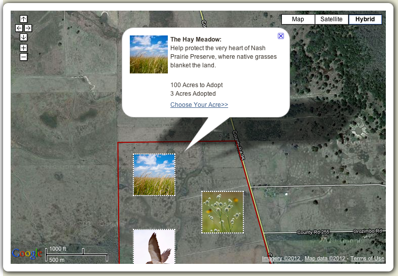
This Google Map shows the Pepperwood Boundaries and more than 900 contributions to the Pepperwood Vital Signs project on iNaturalist.org.

Saturday's training was especially exciting because Morgan demoed the new Android App that iNaturalist developed with the support of a Google Earth Outreach Developer Grant to Pepperwood. By making the contribution of data to museums easy and fun, the Android app clears a major barrier towards recruiting non-scientists to participate.

These reinforcements couldn't have arrived sooner. Plants and animals are disappearing about 1,000 times faster than normal with ongoing climate and land-use change, and one of the most difficult hurdles towards addressing these challenges has been the basic scarcity of information about where plants and animals persist and where they do not. Without the help of non-scientists, the handfuls of museums and graduate students tasked with providing this information simply can't scale to meet these challenges.

Want to get involved? Download the app (on iOS or Android), get outdoors, and start documenting nature from wherever you are in the world! If you want to start your own regional project, like the Pepperwood Vital Signs project, you can do that here. You'll be following in Darwin's footsteps - just don't be tempted to put any beetles in your mouth!

Posted by Scott Loarie, co-director iNaturalist.org
Read More
Posted in Google Earth, Outreach | No comments

Thursday, 23 February 2012

Imagery Update: Week of February 20th

Posted on 13:00 by Unknown

The Google Earth and Maps Imagery team recently published another batch of satellite imagery. In this post, we’ll explore a few well-known locations from across the globe.

Our first example is the Bristol Motor Speedway, located outside of Bristol, Tennessee. This NASCAR short track speedway is the 8th largest sports venue in the world, and hosts up to 165,000 people.

Bristol Motor Speedway, Bristol, Tennessee

If you think the typical NASCAR race is too crowded, how about visiting a location with a few million others on a single day? That’s the estimated crowd size expected each year to the Kaba (shown below), in Mecca, Saudi Arabia, on the day of the annual Islamic pilgrimage Hajj.

The Kaaba, Mecca, Saudi Arabia

Another great place to visit - either virtually or in person - is the Grand Mediation Amphitheatre located in the World Dhammakaya Centre in Pathum Thani Province, Thailand. As shown below, the Centre provides a place where anyone is welcome to meditate.

The World Dhammakaya Centre, Pathum Thani Province, Thailand

If you prefer to spend your leisure time contemplating classic literature, you’ll enjoy this final example from Spain’s central La Mancha region. This perspective view highlights the vineyards and arid plateaus that form the backdrop of The Ingenious Gentleman Don Quixote of La Mancha.

Perspective view of Castile–La Mancha, Spain

If you’d like to receive an email notification when the Google Earth and Maps Imagery team updates your favorite areas(s), we’ve got just the tool: The Follow Your World application!

These are only a few examples of the sites that can be seen and discovered in our latest batch of published imagery. Happy exploring!

Countries/regions receiving high resolution satellite updates:
Albania, Algeria, Angola, Antarctica, Argentina, Armenia, Australia, Austria, Azerbaijan, Bangladesh, Belarus, Belize, Benin, Bermuda, Bolivia, Bosnia and Herzegovina, Botswana, Brazil, Bulgaria, Burkina Faso, Burundi, Cambodia, Cameroon, Canada, Cape Verde, Central African Republic, Chad, Chile, China, Colombia, Costa Rica, Croatia, Cuba, Cyprus, Czech Republic, Democratic Republic of the Congo, Djibouti, Dominican Republic, Ecuador, Egypt, El Salvador, Eritrea, Estonia, Ethiopia, Fiji, Finland, France, Gabon, Georgia, Germany, Ghana, Gibraltar, Greece, Greenland, Grenada, Guatemala, Guinea, Guinea-Bissau, Haiti, Honduras, Hungary, India, Indonesia, Iran, Ireland, Israel, Italy, Japan, Jordan, Kazakhstan, Kenya, Kuwait, Kyrgyzstan, Laos, Lebanon, Lesotho, Liberia, Libya, Lithuania, Macedonia, Madagascar, Malawi, Mali, Marshall Islands, Mauritania, Mayotte, Mexico, Moldova, Mongolia, Morocco, Mozambique, Myanmar, Namibia, Nepal, Netherlands, New Zealand, Nicaragua, Niger, Nigeria, North Korea, Norway, Oman, Pakistan, Panama, Papua New Guinea, Paraguay, People's Republic of the Congo, Peru, Philippines, Poland, Portugal, Qatar, Romania, Russia, Rwanda, Saudi Arabia, Senegal, Serbia, Slovakia, Slovenia, Somalia, South Africa, South Korea, Spain, Sri Lanka, Sudan, Suriname, Svalbard, Swaziland, Sweden, Switzerland, Syria, Taiwan, Tajikistan, Tanzania, Thailand, The Bahamas, The Gambia, Timor-Leste, Tunisia, Turkey, Turkmenistan, Uganda, Ukraine, United Arab Emirates, United Kingdom, United States, Uruguay, Uzbekistan, Venezuela, Vietnam, Western Sahara, Yemen, Zambia, Zimbabwe.

These updates are now available in both Google Maps and Google Earth. For a complete picture of where we updated imagery, download this KML for viewing in Google Earth.

Posted by Eric Kolb, Geo Data Strategist
Read More
Posted in Google Earth, Google Maps, imagery | No comments

Wednesday, 22 February 2012

Enhanced search in Google Earth 6.2

Posted on 07:00 by Unknown

Lao-tzu once said, “The journey of a thousand miles begins with a single step.” In Google Earth, that single step is often searching for the name of the place you want to go. The search field is the gateway to all of the amazing places you might visit, and for the recent release of Google Earth 6.2, we worked hard to make it even more powerful and easy to use.

As a result, searching for a location in Google Earth 6.2 is a bit different: we’ve streamlined the look and feel of the search interface, removing tabs and consolidating all the search fields together into one (just like Google Search). We’ve also added features that Google Earth previously didn’t have, like transit directions and search layers. And we’ve made sure that underneath these shiny new features, you still have access to the power and flexibility of KML.

If you live in one of the many metropolitan areas supported by Google Transit, you’ve probably used the transit directions search on Google Maps to plan a trip. Now you can do the same thing in 3D with Google Earth. Select “Get Directions” and enter your endpoints, then choose the train icon at the top of the search results for public route instructions. You can also click on any of the transit stations or stops to fly there. Be sure to turn on 3D buildings - some train stations are really quite pretty! You’ll also notice icons for walking and biking directions, so if you’ve ever wanted to go on a virtual tour of your next cycling excursion, or find out just how steep that hill is before you commit to the journey, now you can.

New transit directions in Google Earth 6.2

Search layers were first introduced in Google Maps a few years ago, and at last, they’ve recently made their way to Google Earth. Search layers enable you to see all the results of your search on the map at once, not just the top ten, making it easy to find clusters of certain types of businesses like fast food restaurants or coffee shops. One of the more entertaining uses of search layers that I’ve found has to do with a road that will be familiar to anyone who’s visited California: El Camino Real. Stretching from Sonoma Valley to San Diego, El Camino is a great place to find shops and restaurants of all kinds - and lots of them! Here’s a search layer for all the pizza places in the San Francisco Bay area; can you spot El Camino?

Search in Google Earth is much more than a pretty face, though. Just beneath the surface lies the powerful KML language, which you can use to take full control of your searches. Right-click on any search listing to save it to My Places or copy it as KML text, or click one of the icons below the search results to save or copy everything all at once. Save your walking directions to My Places and start a tour of the route to get turn-by-turn directions from the comfort of your chair. You can also click on “History” below the search field to see all of your recent searches at once, and selectively hide and show results to get, say, a picture of the top ten hotels and crêpe restaurants in Paris, for optimal crêpe-eating efficiency.

We’ll continue to improve the search experience in Google Earth, so stay tuned, and keep those searches coming!

Posted by Brian Ellis, Software Engineer, Google Earth
Read More
Posted in Google Earth, Transit | No comments

Tuesday, 21 February 2012

Street View on Google Maps comes to Russia

Posted on 15:22 by Unknown

Welcome to Russia! You can now virtually travel through the world’s largest country to the cities of Moscow and St. Petersburg using Google Maps Street View.

Take an online stroll around famous Red Square and Moscow Kremlin, or go to outskirts of Moscow to wander around the beautiful Tsaritsino or Kuskovo parks. You can also visit the former site of the palace in Kolomenskoye, once considered the 8th World Wonder.

View Larger Map

Red Square, Moscow

St. Petersburg, the second largest city in Russia and northernmost megapolis in the world, was once a country capital, and the history of this young city started with The Peter and Paul Fortress. Today, the entire historical center of St. Petersburg is a UNESCO Heritage Site that you can enjoy via Street View.

View Larger Map

Historical Center, St. Petersburg

Within St. Petersburg, you can see the great palaces and parks that Russian emperors and nobles built, with Peterhof being its crown jewel. In fact, whole southern shore on the Gulf of Finland consists of palaces and parks including Peterhof, the Oranienbaum, and Alexandria.


View Larger Map

Peterhof, St. Petersburg

We hope you enjoy your virtual trip to Russia, and look forward to sharing more countries, cultures and sites as Street View continues to expand to more places. For a demo on how Street View works, start here.

Also, if you have a story to share about a place in Russia, find it in Street View and share it on Google+ with the #streetview.

Posted by Boris Khvostichenko, Product Manager, Google Russia
Read More
Posted in imagery, Russia, Street View | No comments

Wednesday, 15 February 2012

Lay claim to your personal conservation plot with Adopt-an-Acre

Posted on 12:00 by Unknown

One of my favorite quotes is by American anthropologist Margaret Mead: “Never doubt that a small group of thoughtful, committed citizens can change the world. Indeed, it is the only thing that ever has.”

We can each play an active role in changing the world for the better by preserving areas we care about. The Nature Conservancy has just made it easier with their Adopt-an-Acre program. They’ve updated their mapping tool today as the result of a Google Earth Outreach Developer Grant, which offers funding to organizations that create clever, cutting-edge applications using Google mapping technologies.

One of the solutions for widespread habitat loss is to acquire large plots of land for conservation. Since 1991, the Adopt-an-Acre program has protected more than 600,000 acres spanning from North America to Africa and Australia, even protecting offshore areas critical for delicate coral reefs and humpback breeding grounds.

Adopt an acre through the Nature Conservancy

There are two featured areas that allow you to adopt a specific acre, the Nash Prairie Preserve in Texas and the Warm Springs Mountain Preserve in Virginia. Simply fly to ground level on the embedded Google Map and choose your acre. You can also select your plot through Google Earth by clicking on the “View in Google Earth” link. This map enables any interested individual to make a pledge and help restore an acre of land to its pristine state.

The Nash Prairie Preserve in Texas is a beautiful and vital tall prairie grassland. These prairies used to cover wide expanses in the Bottomlands region of coastal Texas, but these areas have been reduced due to metropolitan encroachment. More than 120 bird species and 300 plant species thrive in this disappearing ecosystem, which you can help protect.

The Warm Springs Mountain Preserve in Virginia is the other area within a 77,000 acre wildlife corridor where you can adopt a specific acre. If you have a connection to the Allegheny Mountains in Virginia, or if you are passionate about preserving species like the interior dwelling songbird, you can choose from a variety of landscapes, pristine rivers and mountain forests to conserve.

Best of all, you can adopt an acre in the name of a loved one or as a gift to someone else. Their name will appear on the map alongside others who have entered their names in support of preserving our wild America.

Learn more about what nonprofits have done with mapping technologies on the Google Earth Outreach website.

Posted by Tanya Birch, Google Earth Outreach
Read More
Posted in Google Earth, Google Maps, Outreach | No comments

Tuesday, 14 February 2012

Celebrate Kisses Across Canada

Posted on 09:00 by Unknown
First kisses, last kisses and all those kisses in between... here’s your chance to kiss and tell!

Just in time for Valentine’s Day, the Canada Kiss Map is a Google Maps API powered application that enables users to share the stories and locations of their most memorable smooches.

from www.torontokissmap.com

Creator Chris Kay Fraser teaches creative writing and moonlights as an independent Maps API developer. She views this clever use of the Google Maps API as an opportunity for Canadians to share their romantic tales. All entries are anonymous and must be 500 characters or less.

Fraser launched a smaller scale version of the project in the summer called the Toronto Kiss Map which already has thousands of entries. As Fraser told the Canadian Press, “people have responded in incredible ways.”

Check it out for yourself, and Happy Valentine’s Day to all our users - in Canada and around the world!

Posted by Aaron Brindle, Google Canada
Read More
Posted in | No comments

An easy way to access directions and locations you care about

Posted on 07:00 by Unknown
If you’re anything like me, you might use Google Maps to look up the same places and directions more than once, like the location of your hotel while you’re on vacation, or directions to a friend’s house that you’ve visited before. When you’re signed in to your Google account, the My Places tab on Google Maps makes it easy to find starred locations, places you’ve rated and checked-in, saved Custom Maps, and even past local searches.

Now, when you visit My Places, you’ll see directions you’ve recently looked up appear on the panel to the left of the map. You can also filter the results to access only these previous directions from the ‘More’ tab.


This historical archive of directions results makes it quicker and easier to continue planning later. For example, if you have a few minutes to spare during the day and use your work computer to search for directions from your house to the restaurant where you’re meeting friends for dinner, you can easily access those same directions from your home computer via My Places once you’re ready to head out. We’ll even remember when you’ve customized your directions by dragging the blue line to your preferred path, and show that you route again.

These past directions and places will only appear for signed-in users who enable Web History. And like other items in My Places, it’s simple to remove any of the locations or directions via the drop-down arrow next to each item.

Whenever you need to access or organize your important places and directions, just visit Google Maps and click on the My Places button to get started.

Update (2/15): Sorry for the delay, but the new feature for viewing saved directions in My Places will be available soon. We'll update this post again when the feature is live.

Update (2/18):  The feature is now live on Google Maps. Thank you for your patience!

Posted by Tatsuo Nomura, Software Engineer, Google Maps
Read More
Posted in directions, Google Maps, my places | No comments

Monday, 13 February 2012

Map your campus and win: Announcing the first Map your University competition

Posted on 12:00 by Unknown

Have you ever wished you knew the most direct route from your dormitory to your geography class across campus? Do you want a great way to help your roommate finally discover the library before midterms? Now is the perfect time to form a team and ensure that your university map is up to date using Google Map Maker. Today we’re kicking off the first ever Map your University 2012 competition for the United States and Canada!

From February 13th until March 9th, 2012, Google invites students studying in the United States and Canada to become local experts by updating and adding detail to their campus maps for viewing in Google Maps and Google Earth. Adding everything from walking paths to university buildings to local businesses will help students and visitors alike when trekking across your college grounds. Winning teams will be selected based on the thoroughness and accuracy of mapping in and around campus, and a brief personal statement. Fabulous prizes include Android tablets and phones, GPS devices, Google Map Maker messenger bags, t-shirts, and more!

The beautifully mapped University of California Berkeley Campus, completed by participants in the 2011 US Map Maker Roadshow.

Many university students around the world are already hard at work mapping their schools. UC Berkeley, pictured above, was among 18 universities that participated in the 2011 US Map Maker Roadshow, as was Lehman College, where students mapped almost their entire campus in one day! Over 700 attendees across the country participated in hands-on mapping workshops and mini-competitions with the help of Google’s Student Ambassador Program.

Now it’s your chance to make your university shine for all the world to see on Google Maps and Google Earth. For more information about how this powerful tool works, rules and registration, be sure to visit the contest homepage. The winning team will be announced in early April. Good luck, and happy mapping!

Posted by Catherine Moats, Community Manager, Google Map Maker
Read More
Posted in competition, Google Earth, Google Maps, Map Maker | No comments

Connect with people and places you love this Valentine’s Day

Posted on 07:30 by Unknown
(Cross posted on the Official Google Blog)

A few months ago we shared an engagement story about a Google engineer who used Google Maps to help coordinate an elaborate proposal to his girlfriend. It served as a great example of how Google Maps can be more than just a handy tool for directions; it can help connect you to the places and people you love.

With Valentine’s Day right around the corner, we were once again reminded of the unifying power of maps through our ongoing work with one of America’s most famous malls, Mall of America in Bloomington, Minnesota. We recently collaborated with Mall of America to conveniently bring its indoor floor plans and My Location information to Android mobile users. As the largest indoor retail space in the United States—complete with a theme park and aquarium—finding your way around Mall of America can be challenging. So we mapped it, enabling you to quickly and easily see where you are and what’s around you from the palm of your hand.

Check out the video below to see how the enormous Mall of America can be scaled down to a romantic setting for two.


Whether it’s through a customized scavenger hunt, search results for a local store with the perfect gift or the best directions to get to your date on time, we hope Google Maps helps you navigate your way to a wonderful Valentine’s Day.

Posted by David Kim, Product Marketing Manager, Google Maps
Read More
Posted in Google Maps, Indoor Maps, Mall of America | No comments

Thursday, 9 February 2012

Share your Google Earth adventures on Google+

Posted on 10:30 by Unknown

Millions of people use Google Earth to explore exotic islands, re-visit their childhood homes, and scout out day hikes. Are you one of them? If so, why not share your virtual travel with friends and family?

With the recent release of Google Earth 6.2, you can easily share screenshots of your explorations with the people in your Google+ circles. Give it a try: just open Google Earth, sign in to your Google account via the button on the top right, and click “Share” to send a snapshot of your 3D view to your Google+ stream. Watch how easy it is to share:


We’ve already seen fantastic Google Earth land and cityscapes shared on Google+, not to mention solar systems, ocean topography, Street View scenes, weather forecasts, gigapixel photography and more. If you can find it in Google Earth, you can share it on Google+.

With Google Earth 6.2, you can easily share your Google Earth adventures on Google+.

And if you’re looking to engage with like-minded cartographers, add the new Google Earth +Page to your Google+ circles and share your own Google Earth snapshots with us. Use the hashtag #GoogleEarthSnapshot in your image description and we could include your photo in a community album on Google+!

There’s a world full of geo enthusiasts out there, so check our Google+ page often to share in the exploration.

Posted by Mark Harrison, Community Manager
Read More
Posted in Google Earth, Google Plus, Google+ | No comments

Tuesday, 7 February 2012

New 45° imagery available for 24 cities

Posted on 16:22 by Unknown


Our February update of 45° aerials contains imagery of 15 U.S. and 7 international locations in Google Maps.

Heidelberg is a university town in southwestern Germany, located at the Neckar river. A former residence of the Electoral Palatinate, Heidelberg is popular among travellers for its historic city center and castle ruins of red sandstone in a mix of architectural styles. Having been around for more than 600 years, the University of Heidelberg is one of Europe’s oldest institutions of higher education.


View Larger Map

San Sebastián (Donostia in Basque) is a Spanish town located on the northern Iberian Peninsula along a bay that’s shaped like a seashell. The San Sebastián International Film Festival has given the town international renown.


View Larger Map

Carmel-by-the-Sea, situated along Highway 1 in California’s Monterey County, is famous for the Spanish Mission founded there in 1770. Its mild climate and the variety of nature and wildlife that can be experienced on the famous 17-Mile Drive around Monterey Peninsula make it popular among artists and tourists alike.


View Larger Map

Located along the estuaries of the RÍo de la Plata, Buenos Aires is the largest city in Argentina and the second largest metropolitan area in all of South America. Founded in 1536, the city is recognized for its eclectic Italian and Spanish-influenced architecture and rich cultural life.


View Larger Map

Have fun exploring the new sites!

Here is a list of updated cities:

US:
Charleston-Folly Beach, SC; Lee’s Summit, KS; Lexington, SC; Magna (Salt Lake City), UT; North Charleston, SC; Pine Island Center, FL; Plymouth, MN; Salinas CA; Santa Rosa, CA; Shawnee, KS; South Hill, WA; Spanish Springs, NV; Killeen, TX; Decatur, AL

Europe:
Torrelavega, Spain; Pamplona, Spain; San Sebastian, Spain; Bailen, Spain; Rolle, Switzerland; Ponferrada, Spain; Wachtberg, Germany; Weinheim, Germany

South America:
Buenos Aires, Argentina

Posted by Bernd Steinert, Geo Data Specialist
Read More
Posted in | No comments

Thursday, 2 February 2012

A clearer view of the seafloor in Google Earth

Posted on 12:00 by Unknown

More than two-thirds of Earth is covered by oceans. If you drained all of that water away, you'd see huge basins that have never been explored, an undiscovered planet in our own backyard.

Today is the three year anniversary of an explorable ocean seafloor in Google Earth. We just released a major update to our global underwater terrain dataset, called bathymetry, from the Scripps Institution of Oceanography, in partnership with NOAA, the US Navy, NGA, and GEBCO (with major contributions from IFREMER and IBCAO).

The update covers ocean topography from all over the globe and reveals our most accurate view of the seafloor to date. This new detail comes from spacecraft measurements of bumps and dips in the ocean surface as well as shipboard soundings from surveys carried out by over 40 countries. With this update to ocean terrain data in Google Earth, 15 percent of the seafloor is now available at 1 km resolution.

You may remember a Sun article reporting the discovery of a street grid where it’s believed the lost city of Atlantis would have been located off the West Coast of Africa. The discovery turned out to be a data artifact related to the way data was collected from a ship sailing back and forth to survey an unknown area. This recent seafloor update has been improved to blend better, and “Atlantis” has again disappeared into legend.

Previous terrain data showed what appeared to be a city grid on the ocean floor (left), which was confused for the lost city of Atlantis. Updated data more accurately reflects the seafloor terrain (right).
(Click on image to enlarge)

Another place you’ll notice an improvement in the ocean terrain data is the Mediterranean Sea, particularly south of Cyprus, where the boundary between the Eurasian and Arabian plates is now more clearly defined.

The Mediterranean Sea: before (left) and after (right)
(Click on image to enlarge)

Our last example shows improvements to the land-sea mask along the coastline of Guam. You’ll notice a dramatic improvement in the resolution of both the coastline and neighboring Mariana’s Trench, the deepest trench in the world.

Guam and Mariana’s Trench before (left) and after (right)
(Click on image to enlarge)

In order to make this update possible, our partners at the Scripps Institution of Oceanography at UCSD have curated 30 years of data from more than 8,000 ship cruises and 135 different institutions. If you’d like to get a closer look at these changes, watch our video tour of this new terrain.

We hope you enjoy diving deeper than ever in Google Earth!

Posted by Jamie Adams, Ocean Team
Read More
Posted in Google Earth, imagery, ocean | No comments
Newer Posts Older Posts Home
Subscribe to: Comments (Atom)

Popular Posts

  • Take off for the holidays with Google Street View
    Whether it’s touring the canals of Venice , swimming with the seals in the Galapagos or climbing the Burj Khalifa in Dubai, Street View ha...
  • Help improve the “blue dot” for people visiting your venue
    When we announced the availability of indoor maps for Android last November , we also introduced Google Maps Floor Plans as a tool for busi...
  • New Maps domains in 11 countries in Middle East & North Africa
    [Cross-posted from the Google Arabia Blog - in Arabic] With the growing numbers of Internet users in the region, we noticed that a huge num...
  • Get a better view of natural geography with Google Maps
    When you look at Google Maps, we want you to see the most comprehensive, accurate and easy-to-understand representation of the entire world....
  • See the seafloor like never before on World Oceans Day
    Only a tiny fraction of our oceans have ever been explored. As a matter of fact, we know more about the surfaces of Mars and the Moon than w...
  • Imagery Update - Week of January 24th
    The Google Earth and Maps Imagery team has just released another aerial and satellite imagery update! January is the month of resolutions an...
  • Refocused Design Evolution, Continued
    In June we launched the start of a comprehensive visual redesign for Google Maps founded on three key principles: focus, elasticity, and ef...
  • New Crisis Response maps feature preparedness information for Hurricane Sandy
    Update Nov. 1, 2012 :  We're constantly looking for ways to improve our ability to help in a crisis. Please tell use how you're usi...
  • Google Map Maker now available in South Africa and Egypt, and coming soon to more corners of the globe
    From the wild grasslands of Kruger National Park to the the extraordinary pyramids of Giza, the world is ripe with wonders waiting to be exp...
  • New 45° imagery available for 19 cities
    The latest 45° imagery update in Google Maps features new imagery for 8 international locations and 11 U.S. locations. This also marks the f...

Categories

  • #treasuremap
  • +1
  • 3D
  • 8bitmaps
  • Adwords Express
  • Africa
  • Amazon
  • Andorra
  • Android
  • api
  • Art Project
  • Audi
  • biking
  • Boost
  • Boulder
  • Brazil
  • Bulgaria
  • Business Photos
  • Canada
  • check-in
  • community
  • competition
  • contest
  • crisis response
  • Culture
  • custom maps
  • developer
  • Developers
  • directions
  • disaster response
  • discovery
  • Download Free Nokia 6680 PC Suite
  • Download Micromax pc suite
  • Download Micromax pc suite for window
  • Download micromax Q5 Pc suite
  • Download PC suite
  • Download Samsung Mobile Pc Suite
  • earth outreach
  • education
  • Enterprise
  • Estonia
  • Europe
  • Fusion Tables
  • galaxy s2
  • Gibraltar
  • GMM
  • google
  • Google Earth
  • Google Earth Engine
  • Google Map Maker
  • Google Maps
  • Google Maps API
  • Google Maps Engine
  • Google Maps for Mobile
  • Google Maps Navigation
  • Google Maps Transit
  • Google Places
  • Google Plus
  • Google Search
  • Google Street View
  • google.org
  • Google+
  • googlenew
  • Grand Canyon
  • ground truth
  • Halloween
  • historical
  • history
  • Hotpot
  • HTC PC Suite Download
  • HTC PC suite for WIN 7
  • HTC PC Suite Free Download
  • HTC sync Downlaod
  • HTC Sync Download for windows
  • HTC Sync Free Download
  • Hungary
  • imager
  • imagery
  • Indoor Maps
  • iPhone
  • Iraq
  • Japan
  • Latitude
  • Latvia
  • layers
  • LG Mobile PC Suite
  • LG Mobile Support Tool
  • LG PC suite Download
  • Lithuania
  • London
  • Malaysia
  • Mall of America
  • Map Maker
  • mapsgl
  • Matt Harding
  • Mexico
  • Micromax A110
  • Micromax Canvas 2
  • Micromax pc suite download
  • Micromax PC suite for windows
  • Micromax Q5 FB PC Suite Free Download
  • Micromax Q5 FB PC Suite Free Download For Windows
  • Mircromax Q3 PC Suite Download for windows
  • Mobile
  • Monticello
  • My Maps
  • my places
  • my tracks
  • navigation
  • new Google Maps
  • Nokia 5250 PC Suite Free Download
  • Nokia 5530 PC Suite Free Download
  • Nokia 5610 PC Suite Free Download
  • Nokia 5800 PC Suite Free Download
  • Nokia 6030 PC Suite Free Download
  • Nokia 6680 PC Suite Download for windows
  • Nokia 6680 PC suite free Download
  • Nokia Asha 305
  • Nokia Asha 306 PC Suite download
  • Nokia C3-01
  • Nokia Free Suite
  • Nokia Mobile PC suite Download
  • oblique imagery
  • ocean
  • offline maps
  • Outreach
  • Pakistan
  • Panoramio
  • Parks Canada
  • Pegman
  • photo tours
  • photos
  • picasa
  • Quiz
  • real estate
  • Russia
  • Samsung C3322 PC Suite Free Download
  • Samsung C6712 PC Suite Free Download
  • Samsung Corby 2 PC Suite Free Download
  • Samsung Galaxy
  • Samsung Galaxy 5830 PC Suite Download
  • Samsung Galaxy Ace Hugo Boss
  • Samsung Galaxy Ace PC Suite Download
  • Samsung galaxy I8190 S III PC Suite Download
  • samsung galaxy mega
  • Samsung Galaxy Mega 5.8
  • Samsung Galaxy Mega 6.3
  • samsung galaxy s2
  • Samsung Galaxy Stratosphere II I415
  • samsung GT-I9100 pc suite
  • Samsung GT-S6102 Galaxy Y Duos PC Suite Download
  • Samsung GT-S6102 PC Suite Download
  • Samsung I9000 Galaxy S PC Suite Download
  • Samsung mobile pc suite downlaod
  • samsung mobile pc suite download for Windows 7 ad XP
  • samsung mobile pc suite download for Windows 7 and XP
  • Samsung N7100
  • Samsung Note 2
  • Samsung Note II
  • Samsung PC Suite Download.
  • Samsung Wave Y Drivers Download
  • Samsung Wave Y PC Suite Free Download
  • Santa
  • Santa Tracker
  • search stories
  • SketchUp
  • Slovakia
  • Slovenia
  • Sony PC Companion Free Download
  • Sony PC Suite Free Download
  • South Sudan
  • space
  • Spain
  • sports
  • Street View
  • Sumsang C3322 Drivers Download
  • SXSW
  • Tags
  • Thomas Jefferson
  • Thomas Jefferson Foundation
  • Tip of the week
  • tour guide
  • traffic
  • Train
  • Transit
  • trees
  • Trekker
  • U.S. National Park Service
  • Ukraine
  • University of Virginia
  • voice search
  • walking
  • Waze
  • weather
  • webgl
  • Xperia PC Suite Download
  • zagat

Blog Archive

  • ►  2013 (87)
    • ►  November (7)
    • ►  October (3)
    • ►  September (4)
    • ►  August (9)
    • ►  July (13)
    • ►  June (12)
    • ►  May (10)
    • ►  April (9)
    • ►  March (11)
    • ►  February (2)
    • ►  January (7)
  • ▼  2012 (192)
    • ►  December (9)
    • ►  November (5)
    • ►  October (24)
    • ►  September (13)
    • ►  August (15)
    • ►  July (18)
    • ►  June (21)
    • ►  May (17)
    • ►  April (19)
    • ►  March (26)
    • ▼  February (12)
      • Follow in Darwin's footsteps with the iNaturalist ...
      • Imagery Update: Week of February 20th
      • Enhanced search in Google Earth 6.2
      • Street View on Google Maps comes to Russia
      • Lay claim to your personal conservation plot with ...
      • Celebrate Kisses Across Canada
      • An easy way to access directions and locations you...
      • Map your campus and win: Announcing the first Map ...
      • Connect with people and places you love this Valen...
      • Share your Google Earth adventures on Google+
      • New 45° imagery available for 24 cities
      • A clearer view of the seafloor in Google Earth
    • ►  January (13)
  • ►  2011 (234)
    • ►  December (13)
    • ►  November (17)
    • ►  October (19)
    • ►  September (15)
    • ►  August (23)
    • ►  July (25)
    • ►  June (20)
    • ►  May (20)
    • ►  April (23)
    • ►  March (24)
    • ►  February (18)
    • ►  January (17)
  • ►  2010 (21)
    • ►  December (21)
Powered by Blogger.

About Me

Unknown
View my complete profile