Your Mobile Support

  • Subscribe to our RSS feed.
  • Twitter
  • StumbleUpon
  • Reddit
  • Facebook
  • Digg

Wednesday, 29 June 2011

Lots of 45º imagery just in time for summer vacation

Posted on 14:45 by Unknown


School is out and it’s time to pack those bags and get ready for summer vacation! We’ve been working hard to get everyone the latest imagery from all over the world. Does your family have any annual traditions? If not, now is a great time to start some, check out our latest additions for some great ideas on where to travel this summer.

What a better way to start a tradition than to visit the happiest place on earth, Disneyland in Anaheim, CA! Use Google Maps to scout out the area, plan out your multi-day adventure all in the comfort of your own home before you head out and enjoy the sites and scenes found there.


View Larger Map

While you’re in sunny Southern California, you can check out Downtown Los Angeles, Universal Studios in Hollywood or visit the Staples Center, home of the 16-time NBA Champions Los Angeles Lakers.


View Larger Map

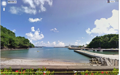
If you’re a baseball fan, nothing says summer like a good ole fashioned baseball game. Grab your baseball cap and head over to the Baseball Grounds of Jacksonville in Jacksonville, FL, home of the Suns! Downtown is just around the corner from the stadium.


View Larger Map

So whether it’s by plane, train or automobile, from all us at Google, have a great and safe summer. Check out the this map that shows you where all of our 45º imagery lies.

Full list of updated cities:
Anaheim, CA. Jacksonville, FL. Tampa, FL. North Las Vegas, NV. Los Angeles, CA. Downey, CA. La Chaux de Fonds, CH. Visalia, CA. Corona, CA. Meadowlake, NM. Continental Ranch, AZ .Picture Rocks, AZ. Greater Sun Center, FL, Bastrop, TX. Martinez, CA. Paradise Valley, AZ. West New Orleans, LA. Fentress, VA.

Posted by Wayne Thai, Geo Data Strategist
Read More
Posted in Google Maps, imagery | No comments

Google Earth API and StrataLogica: Changing Education

Posted on 14:00 by Unknown
Cross-posted on the Google Enterprise Blog

Editors note:
The Google team encounters fun and new ways of using the Google Earth and Maps API. Here’s an example of how a century old educational map and globe publishing company realized more students wanted to learn online and transformed their teaching methods to include a program built on the Google Earth API. Don Rescigno, from Herff Jones | Nystrom, explains how students and teachers benefit from technology in the classroom with StrataLogica.


With today's technology enabling information to travel at a much more rapid rate than in the past, students feel more advanced than what many of us can remember from our own days in school. Elementary school students use a school computer, manage multiple usernames and passwords, work with spreadsheets, develop their own blogs and websites, and more. They’re tech savvy and they’re connected.

The challenge for educators is to use tools and resources that take advantage of students' advanced technological skills. Combining educational content with technology like the Google Earth API gave us the opportunity to foster a new and immersive experience that changes the way students see our world.

StrataLogica—combined with the Google Earth API —provides students with powerful tools to visualize and comprehend the ways in which geography has impacted events, politics and populations throughout human history. Students have the ability to see current events, taking place around the world, from their classroom.

Using a computer or interactive whiteboard, students uncover layers of educational content and can then drill down to Google Earth’s satellite imagery, see what’s actually there, and even use historical imagery to compare then and now. Recently, I had to play the role of a teacher when one of my children overheard a CNN report on Japan and asked, “Dad, what made the earthquake and tsunami?” The ability to access and interact with so many resources—aerial imagery of the earthquake, videos, and photos posted by Japanese citizens, local news stories—allowed me to teach him about the Earth’s processes and their impact. It helped to create a better understanding beyond the news story. It fostered critical thinking and a global perspective.


Like so many with children, I want to see students learning in a new way that
inspires them. It’s important for our future generation to understand how we are all connected — to think globally and comprehend world impact. We want them to truly become global
citizens. StrataLogica and the Google Earth API are helping change the way students see the world; they can “fly” to any location in a matter of seconds, zoom in to imagery and see street views of historical sites that they may never have an opportunity to visit, embed videos and photos, and experience their own virtual field trips.

If you’re an educator interested in teaching geography, history, earth science and
more, visit stratalogica.com to learn more.

Posted by Natasha Wyatt, Google Earth and Maps Enterprise Team
Read More
Posted in Enterprise, Google Earth | No comments

Street View: Our biggest update yet

Posted on 10:25 by Unknown
Since we launched Street View on Google Maps in the U.S. in 2007 we’ve added 26 more countries and enabled you to explore images across all seven continents. Today we’re excited to share with you the latest expansion of Street View because it’s our biggest update yet.

New imagery is now available for 13 of our established Street View countries: Denmark, Ireland, Italy, Spain, Netherlands, Norway, Sweden, Romania, South Africa, Taiwan, Japan, the United States, and the United Kingdom.

I like wine so I’m particularly interested in seeing the new imagery around Italy’s famous Chianti region and other beautiful areas of Tuscany. Across the mediterranean in Spain, the home of another renowned wine is available with the addition of the Rioja province.

Pechina, Rioja Region, Spain

And as a food lover I’m keen on discovering Denmark’s beautiful chain of Smålands Islands - famous for its fruits that have inspired many Danish chefs and the new Nordic cuisine movement. In neighbouring Sweden there has been a significant increase in coverage across the country with Lake Siljan now included, along with the popular tourist towns of Rättvik, Leksand and Mora.

Leksand, Sweden

The southernmost tip of Africa is also now available with the addition of South Africa’s Cape Agulhas. The cape is where the Indian and Atlantic oceans meet and is notoriously hazardous for sailors.

And across the other side of the world, you can view the Pacific Ocean from Japan’s Hahajima, one of the remote Ogasawara islands.

Haha-Jima, Japan

In addition, this latest batch of street-level imagery includes higher resolution panoramic views of places throughout the San Francisco Bay Area, Los Angeles and San Diego. This is great for both locals and potential visitors of these popular California destinations, who can now see even more realistic views of landmarks like the Golden Gate Bridge, Staples Center, and USS Midway.

Golden Gate Bridge, California

Of course, these are just a few of the many fascinating places in today’s release of new Street View imagery, so we encourage you to look around and virtually experience them for yourself right in Google Maps. Be it for armchair travel from the comfort of your computer, or to figure out where you might want to visit on your next vacation, we’re thrilled to continue our expansion of Street View.

Posted by Kei Kawai, Product Manager, Street View on Google Maps
Read More
Posted in Google Maps, Street View | No comments

Tuesday, 28 June 2011

A Refocused Map

Posted on 14:50 by Unknown

Over the years we’ve made some significant improvements to our map style. This summer, we’re starting a new project to give you more map and simplify the overall look and feel. As part of a larger effort, Google is bringing you an experience that’s more focused, elastic, and effortless.

You can still find your favorite west-coast oyster bar in Portland Maine...

Before


After


And take a nice drive to get to there...


Before


After


Whether you use Google Maps to discover new places, or to seek out destinations you know well and love, we hope you’ll find our updated look as familiar and reliable. It’s simple polish with focus on what’s most important—your map.

Posted by Evelyn Kim, Visual Designer
Read More
Posted in Google Maps | No comments

Monday, 27 June 2011

Discover Your World in 3D, again

Posted on 13:15 by Unknown

[Cross-posted from the SketchUp blog]

Today, we’re unveiling a totally redesigned Your World in 3D website. If you’re new to geo-modeling -- the term given to creating 3D buildings for Google Earth and Google Maps -- the Your World in 3D website has all the tools and info you’ll need to get up and running quickly. The new website showcases several examples of what fellow modelers are building and will help connect with other geo-modelers around the world.

So that’s the what, here’s the why. Five years ago, Google acquired a Boulder-based startup called @Last Software, which was making waves in the architectural world with their 3D modeling software, SketchUp. Google had an ambitious idea to add a 3D model of every building on the planet to Google Earth, and SketchUp was a tool up to the task. Not only that, by opening SketchUp to a wider audience, users would have the opportunity to help build a virtual mirror of their world.

Times Square showcases some of the very first user contributed models


Today, the 3D virtual world is in full bloom: hundreds upon hundreds of villages, towns, and cities have been added to the 3D map representing hundreds of thousands of 3D buildings from every corner of the globe -- truly, a testament to the power of open collaboration.

In the intervening half decade, we’ve introduced several new ways of adding buildings to the 3D map, including Google Building Maker and the Cities in 3D program. And you may have noticed 3D buildings surfacing on Google Maps and Google Maps for mobile as well. With so many different ways of creating and viewing 3D models, we realized we needed a destination that would demystify the process of geo-modeling,

Enter: the new Your World in 3D website. We call the website Your World in 3D because it is you, the user, who is helping build this virtual world, and perhaps more importantly, it is you who is finding innovative and surprising ways of using this data.

Your World in 3D has been redesigned from the ground up


Why geo-model? When asked, most geo-modelers say they do it because geo-modeling is just plain fun, but building your town in 3D can also be a great way to show civic pride and encourage tourism for your town. It can also provide an interactive way to promote your business or contextualize the urban planning. 3D modeling has also been used in crisis response situations as we saw in the grassroots modeling effort that happened after the earthquake in L’Aquila, Italy.


Why create 3D models for Google Earth?

We hope you’ll join us on this mission (and adventure) of building the most comprehensive 3D virtual mirror of planet Earth.

Happy modeling!

Posted by Nicole Drobeck, Geo Community Program Manager
Read More
Posted in | No comments

City names in Google Earth, now in your preferred language

Posted on 08:13 by Unknown

We love to give you options on how to view information in Google Earth, but we also want to make sure we're organizing that information in a way that is useful and easy to read. We realize that a city may be referenced in different ways, in different languages. Presenting all of these names on the map in a single view can sometimes make the map harder to read, not to mention, may even detract users from other, useful information. In the interest of providing the smoothest browsing experience possible, we’ve updated Google Earth so that each city has just one label in a user’s default language.

These settings are flexible. If you would like to change the way in which cities are displayed, just follow these instructions to change your default language. If you prefer to see cities in two languages, turn on the ‘Local Place Names’ layer under the ‘More’ folder. This way, if you fly to the capital of Japan, for example, you’ll see both “Tokyo” and “東京“.

Click on “Local Place Names” to turn on a second, local name for each city.

And remember, if you think that there’s a better name for a city in your language, we’d love to hear your feedback via the "Report a Problem" link in the help center.

We hope this makes it even easier and quicker to find information. Keep exploring!

Posted by Kailen Wright, Geo Data Specialist
Read More
Posted in Google Earth | No comments

Thursday, 23 June 2011

Mapping in the Midwest

Posted on 12:00 by Unknown

During one of the Map Maker Community team’s recent college campus events in Chicago, we had the pleasure of meeting Phil Swanson, an international studies and business student, who travelled nearly 200 miles to join our mapping event at the University of Chicago.

As soon as we started talking with Phil, his passion for mapping and computers came shining through, so we were excited to learn more about what drives him to add to, edit, and create using Google Map Maker.


According to Phil, it all started with retrofitting an interactive campus map when he was a web developer at the University of Wisconsin, Platteville. There was an existing version that utilized the Google Maps API, which he further developed, resulting in this useful campus map. Phil says about the project, “I love to make simple things for people to use, and I've always been interested in maps, so that project definitely created an interest in maps and mapping in general.”

Once Phil realized the positive impact his mapping could have on the university, he continued using Google Map Maker to ensure all of the campus details were correct. He began seeing his edits appear not only in Google Maps, but also on Google Maps for mobile on his phone when he searched maps near the university. “Seeing edits transition from Map Maker to Google Maps on mobile and filling in the details make maps that much more useful for me and the world,” Phil said about mapping his town and the campus.


What aspect of the maps does Phil enjoy most? "I love mapping buildings. Seeing the buildings from my University show up on my phone is the best.” Phil has developed a handy system of finding what needs to be fixed on the map, going out with his phone to take pictures, then adding those photos to a web album which he can then include with his edits in Map Maker. “This is especially useful for buildings . . . . It might sound obvious, but I find that my edits are much more likely to get approved if I describe what I'm doing and link to a photo for a more complex edit.” What a helpful technique to use during the review process!

We want to thank Phil for taking the time to hang out with us in Chicago, and also for sharing with us what excites him about mapping. We look forward to seeing more great mapping from Phil, and hope other students are inspired to make the maps of their own colleges and universities more comprehensive and detailed!

For more useful tips like Phil’s, visit the Map Your World Community forum to see what others are doing.

Posted by Catherine Moats, Geo Project Manager
Read More
Posted in Map Maker | No comments

Thursday, 16 June 2011

More Building Maker cities and a new competition, too

Posted on 15:52 by Unknown

[Cross-posted from the SketchUp Blog]

It’s a great day for the citizens of Argentina -- and for Canadians in the nation’s capital. We’ve released new Building Maker imagery in six new cities:

  • Buenos Aires, Argentina
  • Córdoba, Argentina
  • Mar Del Plata, Argentina
  • Mendoza, Argentina
  • Rosario, Argentina
  • Ottawa, Canada

...but that’s not all! To help these cities get modeled, we’re having the first ever modeling competition for Building Maker. Starting today, you can create models in these six cities to win prizes in two different categories: Best Model and Most Models. The first place prize is a GPS-enabled digital camera; second place is a Building Maker shirt; and third is a Google travel mug. Have fun!


Posted by Nicole Drobeck, Geo Community Program Manager

Read More
Posted in | No comments

Wednesday, 15 June 2011

Watch the lunar eclipse from anywhere

Posted on 06:00 by Unknown
(Cross-posted on the Official Google Blog)

We’re always fascinated by the unique wonders of space and the world—what can we say, it’s the geek in us! Naturally, when we learned that part of the world will be treated to a rare 100-minute long total lunar eclipse starting at 11:20am PDT today, we were both excited and disappointed that this rare occasion wouldn’t be visible from our Mountain View campus like last year’s eclipse. We suspect we aren’t alone, so you’ll be glad to know that we’ve worked with Slooh Space Camera to let you experience the spectacle wherever you are in the world, in real time.

Slooh will host a live mission interface using Google App Engine that lets anyone not lucky enough to live in certain areas (South America, Europe, Africa, Asia and Australia) take part in this rare astronomical event. It’s equipped with audio narrations from real-life astronomers so you can hear a firsthand, expert account of the event. You can also watch the live stream on the Google YouTube Channel or from the Sky layer in Google Earth (download this kml), while exploring the fascinating world that exists in our galaxy. Finally, those of you on the go can download the Slooh Space Camera Android app to view the images right on your phone.


If you're fortunate enough to be able to view this event in the sky, we hope you'll get the chance to step outside and indulge in the spectacle. For everyone else, we hope our moon madness helps brighten your day.

Update 11:37 PDT: Starting now, if you visit the Google homepage you’ll see a special interactive doodle, which will update throughout the day to show the latest state of the moon. Lunar imagery provided by Slooh.

Posted by Noel Gorelick, Chief Extraterrestrial Observer and Technical Lead in Special Projects
Read More
Posted in discovery, Google Earth, imagery, space | No comments

My Places now helps you manage your important locations

Posted on 00:00 by Unknown

Almost every day you encounter new places and businesses, whether it’s a new store you spotted on your commute to work, or a restaurant you visited with friends over the weekend. To date, you’ve been able to star places on Google Maps, rate them via Google Places, or add them to a customized map with your own icons and annotations through My Maps.

But keeping track of all the locations you care about and memorizing which places you starred or rated isn’t easy. So today, we’re unveiling the new My Places tab on Google Maps, which helps you quickly view and interact with your saved maps, starred locations, and rated businesses.


The My Places tab replaces the My Maps tab in the Google Maps toolbar. Items are organized by date with your most recent activity at the top, and filters make it easy to sort and view only your maps, starred locations or rated places. And of course, you can still create and share personalized My Maps through the “Create new map” link.

My Places also simplifies your ability to manage the locations that make up your personalized maps experience. Using the drop-down arrow next to each location in your list, you can easily delete any of your saved maps, stars or Google Places ratings. These personalization changes will automatically be synchronized across all other Google properties including Google Places, Google Maps, and Google Maps for mobile.

To use My Places, you’ll need to sign in with your Google account. Try it now: visit Google Maps and click the My Places tab to access and organize the places you care about.

Posted by Hiroki Asakawa, Software Engineer
Read More
Posted in Google Maps, Google Places, My Maps | No comments

Monday, 13 June 2011

Introducing Descriptive Terms in Local Search Results

Posted on 16:09 by Unknown

(Cross-posted on the Google Places and Small Business blogs.)

Whether it’s to find a great place for dinner or to grab a cup of coffee, I often look up places directly on Google Maps. Evaluating my options and making a choice just got even easier thanks to the list of associated terms that now appears directly in the local search results.

Starting today, Google Maps search results in the U.S. and Great Britain will include some of the phrases which are most frequently used to describe those places. These phrases come from sources all across the web, such as reviews, web pages and other online references, and they can help people quickly identify the characteristics that make a particular place unique. It’s like an opportunity to ask the business owner or its patrons “What’s good here?” or “What do most people get here?”

For example, if I’m looking for a place to relax and enjoy a great cup of coffee this weekend, I can see at a quick glance that Cafe Grumpy could be the perfect spot. Besides being known for their “latte” and “great coffee,” they have a “no laptop” policy — exactly what I was hoping for since I’d like to unplug and take a break from work this weekend.


Or if I’m planning to visit friends on the west coast and need to organize a night out, Rose & Crown could be an excellent choice given their “great beer selection” and “trivia night” games on site!


Whether you’re looking for local businesses in your neighborhood or in another city, these descriptive terms can help you find the places right for you. We hope you use these terms to discover new and interesting places on Google Maps, and watch for this feature to appear in Place search on Google.com and Google Maps for mobile soon!

Posted by Manjunath Srinivasaiah, Software Engineer
Read More
Posted in Google Places | No comments

Friday, 10 June 2011

3D trees in Google Earth - now in more cities around the world

Posted on 12:15 by Unknown

Last month, we celebrated the trees of the great American wilderness on Arbor Day. Unfortunately, many of us don’t get the opportunity to visit majestic forests like these very often, which is why we're making them available on Google Earth.

Since we first launched 3D trees in Google Earth 6 last November, we’ve worked to bring this experience to more cities. Today, we are happy to announce that the latest group of cities with 3D trees include: New York, Philadelphia, Boston, London and multiple cities in the California Bay Area.


This new 3D imagery brings new perspective to your favorite historical buildings and parks. In Philadelphia we have complemented the Independence Hall model with new 3D trees in Independence National Historic Park to enhance the realism of the historic site. Other examples are Delacorte Theater in New York City and the the famous Emerald Necklace, a gem of Boston designed by Frederick Law Olmsted, a shared experience and memory for many people – locals and visitors alike.

Independence Hall in Philadelphia, Pennsylvania


Delacorte Theater in New York City, New York


Boston Common in Boston, Massachusetts

We hope that among these new cities you find fond memories of a park, a tree lined street, or even a special tree where you’ve had a fun picnic or family outing. To relive those memories by viewing 3D Trees (or start planning to make new ones), make sure you check the “Trees” layer under “3D Buildings” in your Google Earth left panel. Enjoy the new tree-lined city streets and filled-in parks!

Posted by Kay Chen, Geo Program Manager
Read More
Posted in Google Earth, trees | No comments

Thursday, 9 June 2011

A tour of the U.S. Green Building Council's headquarters

Posted on 15:00 by Unknown

[Cross-posted from the SketchUp blog]

You could call our friends at Igloo Studios “multi-taskers”. While they mainly concentrate on creating products and plugins for designers and architects, they also have a podcast, a SketchUp training program and a popular book.

Their latest project is a virtual tour of the U.S. Green Building Council’s headquarters in Washington, D.C. (Note: you’ll need the Google Earth plugin installed to view).


This project is cool for lots of reasons. For starters, USGBC’s 75,000-square-foot facility is loaded with efficient and innovative green features that have earned the building a LEED Platinum rating. Professionals regularly tour the USGBC for real-world examples of successful green practices.

USGBC headquarters

However, not everyone has the luxury of being able to visit Washington DC, so Igloo Studios built this one-of-a-kind Google Earth tour of the building. Using a custom instance of the Google Earth plugin and building product catalogs from the 3D Warehouse, Igloo was able to create a tour of both the exterior and interior of the building!

The tour features interactive elements

As you navigate through the 3D building, you’ll notice it’s jam-packed with other goodies like a guided audio tour, photos and embedded videos. You can even click on the building’s materials and products to learn more about the green tech used in its construction.

Once you finish the tour, you can launch a test that will earn you the same continuing education credits that you would get for taking the live tour.

And the coolest feature of all: if you find a building product during the tour that might be useful in one of your projects, you can download it directly into your SketchUp design!

Learn about building materials and then bring them into your model

If you're interested in learning more about how your products or buildings can be visualized in this way, be sure to send Igloo an email.

Posted by Chris Cronin, SketchUp Pro Sales
Read More
Posted in | No comments

Wednesday, 8 June 2011

See the seafloor like never before on World Oceans Day

Posted on 08:34 by Unknown

Only a tiny fraction of our oceans have ever been explored. As a matter of fact, we know more about the surfaces of Mars and the Moon than we do about our own ocean floor. So in honor of World Oceans Day, we collaborated with Columbia University to add more ocean seafloor terrain to Google Earth than has ever been available before. With the addition of Columbia’s Global Multi-Resolution Topography (GMRT) synthesis data, you can explore half the ocean area that has ever been mapped, an area larger than North America.

The red lines show new seafloor data from Columbia, CSUMB and UH.

Our partners at the Lamont-Doherty Earth Observatory at Columbia have curated 20 years of data from almost 500 ship cruises and 12 different institutions. See the full GMRT attribution layer in the Earth Gallery to learn more. High-res underwater mapping is vital to understanding how tsunamis will spread around the globe. For example, the National Oceanographic and Atmospheric Administration (NOAA) created a Tsunami spread map after the Japan earthquake to allow anyone to visualize the wave spread.

To get started, dive under the ocean surface by clicking any ocean in Google Earth and explore underwater volcanoes, trenches and sea mountain peaks. You can also download this Seafloor Updates kmz file to take a tour of the new high-resolution data.


Explore the Ocean Seafloor tour and others on the Ocean Showcase.

Our 2011 Seafloor Tour video highlights some of the amazing places you’ll find in Google Earth, like the Mendocino Ridge, where the massive Juan de Fuca Plate slides toward western North America.


Deep Sea Vents tour video.

Continue exploring with the Deep Sea Vents Ridge 2000 Google Earth tour, which includes the deepest volcanic eruption ever captured on video at the West Mata volcano, near Fiji. Twenty additional ocean education posts from Ridge 2000 can be found in the Explore the Ocean layer in Google Earth; download this kmz to see them all.

Complete your tour, by checking out the recently published University of Hawaii at Manoa's 50-meter seafloor synthesis for the US Hawaiian islands and California State University Monterey Bay’s new data for Cordell Bank and the Gulf of the Farallones off the west coast of California.

We hope our new high-res terrain data inspires you to dive into the unknown world that is the ocean and discover the many underwater treasures that lie beneath.

Posted by Jamie Adams, Ocean in Google Earth Team
Read More
Posted in | No comments

Know when your bus is late with live transit updates in Google Maps

Posted on 04:00 by Unknown

(Cross-posted on the Official Google Blog)

Often when I’m taking public transit, I arrive at my stop on time only to anxiously check my watch and look down the street for my bus, which is running late once again. Those extra minutes I’m forced to wait seem like an eternity, and the only information I can access on my phone is when the bus was supposed to arrive.

Starting now, Google Maps for mobile and desktop can tell you when your ride is actually going to arrive with new live transit updates. We partnered with transit agencies to integrate live transit data in four U.S. cities and two European cities: Boston, Portland, Ore., San Diego, San Francisco, Madrid and Turin.


When you click on a transit station or plan a transit route with Google Maps and there are delays or alerts related to your trip, you’ll now see “live departure times” (indicated with a special icon) and service alerts.


Live transit departure times after tapping on a station


Live service alerts when receiving transit directions


Live departures and alerts on desktop


We’re working with our public transit partners to help them provide live data to more people in more cities. You can get live transit updates in the latest version of Google Maps for mobile (requires Android 1.6+), as well as Google Maps on all supported desktop and mobile browsers.

Posted by Sasha Gontmakher, Software Engineer
Read More
Posted in Google Maps, Mobile, Transit | No comments

Monday, 6 June 2011

Imagery Update - Week of May 31st

Posted on 09:40 by Unknown

The Google Earth and Google Maps Imagery Team has just published its first batch of satellite and aerial imagery for June, and as always, there are all kinds of fascinating sites and features to check out.

Our first example image shown below is of the Sacred Heart church and its famous gilded dome located on the Notre Dame campus in Notre Dame, Indiana. A church has continuously occupied this site since 1830 and the current basilica foundation was laid in 1868. This aerial imagery was acquired in late April, 2011.

Basilica of the Sacred Heart, University of Notre Dame, Notre Dame, Indiana

When you’re done checking out the beautiful Notre Dame campus imagery, zoom over to Oregon and explore our new aerial imagery of the Salem region acquired this past summer. Below is a section of the Oregon Garden, a botanical garden located in Silverton. In the upper-right corner, you can see the only Frank Loyd Wright building in the state, the Gordon House. This home is listed on the National Register of Historic Places and was envisioned as a model of affordable homes for the local working-class citizens.

Oregon Garden, Silverton, Oregon

Finally, here’s a satellite image taken in December 2010 of the San Cristóbal Volcano. This active volcano rises above the town of Chichigalpa, locted in Chinandega, Nicaragua. In the image, you can see the gas and ash clouds emanating from the volcano’s caldera. These clouds and prevailing winds have served to remove all vegetation from the volcano’s southwestern flank.

San Cristóbal Volcano, Chichigalpa, Chinandega, Nicaragua.

Do you have a place you love for which you’d like to receive a notification when the Earth and Maps Imagery team updates the site? We’ve got just the tool: The Follow Your World application!

As always, these are but a few examples of the types of features that can be seen and discovered in our latest batch of published imagery. Happy exploring!

High Resolution Aerial Updates:
Fresno, CA; Huntington, WV; Laredo, TX; Los Angeles, CA; Manchester, NH; San Francisco Peninsula, CA; Salem, OR; Soldotna, AK; Southbend, IN; Sumter, SC; Victoria, TX.

Countries/Regions receiving High Resolution Satellite Updates:
Albania, Algeria, Argentina, Australia, Azerbaijan, Bahamas, Benin, Bolivia, Botswana, Brazil, Burkina Faso, Cambodia, Cameroon, Canada, Cape Verde, Chad, Chile, China, Colombia, Costa Rica, Croatia, Cuba, Democratic Republic of the Congo, Dominican Republic, Ecuador, Egypt, Eritrea, Ethiopia, Fiji, France, French Guiana, French Polynesia, Ghana, Greece, Guadeloupe, Guatemala, Honduras, India, Indonesia, Iran, Israel, Italy, Japan, Jordan, Kenya, Lebanon, Lesotho, Madagascar, Mali, Mauritania, Mauritius, Mexico, Moldova, Mongolia, Morocco, Mozambique, Myanmar (Burma), Namibia, Nepal, New Caledonia, New Zealand, Nicaragua, Niger, Nigeria, Norway, Oman, Pakistan, Papua New Guinea, Paraguay, Peru, Philippines, Poland, Romania, Russia, Saudi Arabia, Senegal, Serbia, Seychelles, Singapore, South Africa, South Korea, Sri Lanka, St. Helena, Sudan, Syria, Taiwan, Tanzania, Thailand, Togo, Tonga, Trinidad and Tobago, Turkey, Ukraine, United Arab Emirates, United Kingdom, United States, Uruguay, Venezuela, Vietnam, West Bank, Western Sahara, Yemen, Zambia.

These updates are now available in both Google Maps and Google Earth. To get a complete picture of where we updated imagery, download this KML for viewing in Google Earth.

Posted by Eric Kolb, Geo Data Strategist
Read More
Posted in | No comments

Friday, 3 June 2011

Our Runners vs. Cyclists Flagstaff Challenge, in 3D

Posted on 13:00 by Unknown

Most office rivalries rise to a boil at conference tables and water coolers. At Google’s Boulder office, our grudge matches play out across topo lines. Last week, our third annual “Flagstaff Challenge” blasted off up Flagstaff Road, Boulder, Colorado’s signature hill-climb. Over 1,500 feet of elevation gain, the Flagstaff Challenge (mapped below) attempts to answer our office’s ultimate water cooler question – what’s really faster: two wheels or two feet?

Bloggers in the office fired up Google’s KML Embed Gadget to cook up an embedded Google Earth course map (if the map below is not in 3D, try installing the Google Earth plug-in, then start embedding KML’s on your own site!).


As our route map shows, Flagstaff’s paved switchbacks criss-cross its running trail all the way up to the finish point, making this slice of topography perfect for an office grudge match between cyclists and runners.

While there was a good bit of trash-talking over GMail and in the halls leading up to the Challenge, Googlers generally prefer to let data speak for itself. Minutes after our team returned to the office, folks were already using Google Earth’s GPS tools to visualize tracks and dissect elevation profiles recorded on their My Tracks app or fitness units.

And yes, a few folks from the Docs team even fired up spreadsheets to run statistical analyses on the finish times. After accounting for outliers (those un-named Geo folks who actually got lost!), it turns out that there was no statistically significant difference between the cyclists and the runners. That just means our office feud will have to simmer for another year; enough time to sharpen our fitness and also the Geo tools we use to share and analyze our weekday warrior exploits!


Posted by Mark Harrison, Geo Community Manager
Read More
Posted in Google Earth | No comments

Map Maker mapping workshop and competition

Posted on 10:11 by Unknown


On May 21 and 22, 2011, we hosted a series of Google Map Maker events in Rabat, Morocco. The events included presentations at the g|Maghreb developer days, and a mapping workshop which took place at the nearby Fondation Mohamed VI. The same evening, we launched a one-week online mapping competition (read on for the results!).


This year’s mapping workshop in Rabat built on the success of a similar event, which took place last year in Casablanca. It was organized by Amine, Mounir and Zohir, official Map Maker advocates from Morocco, in partnership with Evans and Jannine, Googlers working in Sub-Saharan Africa and the Middle East.

The objective of the event was to introduce Map Maker to new users and illustrate that many Moroccans all over the world are helping to improve Google Maps through Google Map Maker. The audience was comprised of over 130 attendees - mostly students, young professionals and developers. They learned how anyone can use Google Map Maker to add to and update maps in over 180 countries and regions. The result is more comprehensive and accurate local maps for millions of people to see in Google Maps and Google Earth. These amazing time-lapse videos of Rabat, Casablanca and Fes show the impressive progress of mappers in Morocco.


The day kicked off with an introduction from Evans. He welcomed the audience and introduced our official advocates, who then took the stage. They engaged the audience with powerful stories of how they got involved with Map Maker and became top mappers. Their passion and enthusiasm was clearly infectious. They also led a demonstration with the audience participating actively, asking and answering questions. We also recognized major contributions made by some of the power mappers in the audience by honoring them on stage.

“I was astonished to discover that my city is not mapped. There was only its name, so I felt a little bit sad and excited at the same time, because I will get the chance to contribute in making my city known around the world.” - Siham K.

Before ending the day, we announced a one-week online competition open exclusively to attendees of the mapping workshop. It concluded just a couple of days ago with impressive results. We are thrilled to announce the winners -- congratulations to Jalal L. in first place, Ilyasse M. in second place, and Mohammed Y. in third place!


It is not too late to register for and participate in another online Map Maker competition focused on mapping Morocco, Tunisia and Algeria (click here for more information and to register).

Congratulations again to our winners! Thanks again to everyone involved in this event -- please stay tuned for more about Map Maker and future mapping workshops in the region. You can view more photos here and find more information at mappingmorocco.com or on Twitter.

We invite you to join a local Map Your World community forum and start mapping at google.com/mapmaker. Happy Mapping!


Posted by Jannine Versi, Product Marketing Manager
Read More
Posted in | No comments

Thursday, 2 June 2011

Run Anywhere in the World With iFit Live Powered By Google Maps

Posted on 09:25 by Unknown

(Cross-posted from the Google Enterprise Blog)

Editor’s note: From time to time we like to showcase how our customers are building fun and innovative products with Google Maps. Colleen Logan, VP of Marketing for Icon Health & Fitness, explains how a Google Maps API Premier powered treadmill helps exercisers reach personal fitness goals.

Most people use Google Maps for reasons of pure function: Where is that new restaurant? How do I get there? How long will it take? We thought Google Maps could be used for an entirely different purpose – as entertainment while working out on the NordicTrack home fitness equipment.

People buy fitness equipment for a range of reasons – train for a race, lose weight or simply stay in shape – but a universal challenge for most is staying motivated and finding the time to exercise. In order to reach their goals, more people are turning to technology for time-saving, motivating exercise. We thought the visuals provided by Google Maps, combined with our fitness products and iFit website might be so compelling, consumers would have more fun and stay on track. Even if the only time you can squeeze in exercise is in the evenings when kids are asleep in or in the early, snowy mornings of winter before a long day at work, the iFit exercise equipment can bring the experience of exercising on varied terrain into your home.


For example, if you wanted to experience a run through San Francisco’s hilly terrain, you can go to the iFit website and draw a running route on Google Maps. When you get on one of our treadmills, such as the NordicTrack Elite 9500 Pro, the treadmill pulls up Google Maps on the screen with the newly drawn running route. The treadmill mimics the incline of the real world route you are running, thanks to the elevation service of the Google Maps API. The runner experiences a real life running route by seeing the runner’s location move about Google Maps with Street View images flying by a she reaches new personal records.

Posted by Natasha Wyatt, Google Earth and Maps Enterprise Team

Read More
Posted in Google Maps | No comments

Wednesday, 1 June 2011

Europe’s best kept secret revealed in 3D

Posted on 09:23 by Unknown
Brussels is one of Europe’s best kept secrets. As Belgium’s charming capital city, many have enjoyed living there, ranging from Victor Hugo and Karl Marx to Jean-Claude Van Damme. Now, you can discover the riches of Brussels in a virtual 3D visit with Google Earth.


Several thousands of 3D buildings have been added to the city’s map. Using Google Maps with Earth view or Google Earth’s “3D Buildings” layer, you can now visit the city to experience its rich architectural history. See the KML tour in the Google Earth Gallery to take a virtual tour of the 3D landmarks for yourself.

The place to start is the Grand Place / Grote Market, Brussels' central square. Its 17th century landmark guild houses are richly decorated with sculptures, gables and gold patterns and are said to hold the secret formula of alchemy engraved in its facades.


From there, you are only a virtual stones-throw away from the Royal Palace and its neo-classical Place Royale, which was built upon the ruins of Charles Quint’s palace and housed the famous Order of the Golden Fleece's treasure. Today, you’ll find the Magritte museum there, beautifully presenting the life and work of one of the world’s best-known surrealists.


Swivel around to see the impressive Palace of Justice, Brussels’ law courts which presides over the city skyline.


En route you will pass the Notre-Dame-du-Sablon church, one of the finest examples of Gothic architecture in the city.

The next stop is the Cinquantenaire Jubilee Park with its arch built in 1880 to celebrate the 50 years of independence. The large warehouses you see next to the arch used to hold the Mundaneum: the largest historical attempt to categorize and organize the world’s knowledge and make its accessible to all, back in 1900.


Perhaps the most well-known landmark in Brussels is the Atomium, an all-metal building built in 1958, in the shape of an iron atom magnified 165 billion times. From the Atomium, turn around and look back for the best panoramic view on Brussels.


Before leaving Brussels, stop by the European Parliament where 27 nations are slowly but surely morphing into a prosperous and peaceful union. Google Belgium’s office is located nearby, can you spot it?


When you’re finished touring Brussels in Google Earth, head north to Antwerp, where citizens are actively modeling their city with free 3D tools from Google.

You think this is cool? If you’d like to get started modeling your town, you can get started quickly with Google Building Maker (where available).

Enjoy the tour!

Posted by Julien Blanchez, Country Marketing Manager Belgium
Read More
Posted in | No comments
Newer Posts Older Posts Home
Subscribe to: Posts (Atom)

Popular Posts

  • Take off for the holidays with Google Street View
    Whether it’s touring the canals of Venice , swimming with the seals in the Galapagos or climbing the Burj Khalifa in Dubai, Street View ha...
  • A bird’s eye view of The Queen’s Diamond Jubilee procession
    Following the royal wedding in 2011, the eyes of the world will again be on London as we celebrate the Diamond Jubilee of Queen Elizabeth I...
  • New Maps domains in 11 countries in Middle East & North Africa
    [Cross-posted from the Google Arabia Blog - in Arabic] With the growing numbers of Internet users in the region, we noticed that a huge num...
  • Apply now to be the next Google Maps Trekker
    We’re working to build the very best map of the world, and we’d love your help to do it. Today we’re kicking off a pilot program that enable...
  • See the seafloor like never before on World Oceans Day
    Only a tiny fraction of our oceans have ever been explored. As a matter of fact, we know more about the surfaces of Mars and the Moon than w...
  • Get a better view of natural geography with Google Maps
    When you look at Google Maps, we want you to see the most comprehensive, accurate and easy-to-understand representation of the entire world....
  • Help improve the “blue dot” for people visiting your venue
    When we announced the availability of indoor maps for Android last November , we also introduced Google Maps Floor Plans as a tool for busi...
  • Refocused Design Evolution, Continued
    In June we launched the start of a comprehensive visual redesign for Google Maps founded on three key principles: focus, elasticity, and ef...
  • Google Map Maker now available in South Africa and Egypt, and coming soon to more corners of the globe
    From the wild grasslands of Kruger National Park to the the extraordinary pyramids of Giza, the world is ripe with wonders waiting to be exp...
  • Visit the Hiroshima Peace Memorial in Street View
    We’ve added many historic sites to Street View to let you explore these places online, and now we’ve included Street View imagery of the Hir...

Categories

  • #treasuremap
  • +1
  • 3D
  • 8bitmaps
  • Adwords Express
  • Africa
  • Amazon
  • Andorra
  • Android
  • api
  • Art Project
  • Audi
  • biking
  • Boost
  • Boulder
  • Brazil
  • Bulgaria
  • Business Photos
  • Canada
  • check-in
  • community
  • competition
  • contest
  • crisis response
  • Culture
  • custom maps
  • developer
  • Developers
  • directions
  • disaster response
  • discovery
  • Download Free Nokia 6680 PC Suite
  • Download Micromax pc suite
  • Download Micromax pc suite for window
  • Download micromax Q5 Pc suite
  • Download PC suite
  • Download Samsung Mobile Pc Suite
  • earth outreach
  • education
  • Enterprise
  • Estonia
  • Europe
  • Fusion Tables
  • galaxy s2
  • Gibraltar
  • GMM
  • google
  • Google Earth
  • Google Earth Engine
  • Google Map Maker
  • Google Maps
  • Google Maps API
  • Google Maps Engine
  • Google Maps for Mobile
  • Google Maps Navigation
  • Google Maps Transit
  • Google Places
  • Google Plus
  • Google Search
  • Google Street View
  • google.org
  • Google+
  • googlenew
  • Grand Canyon
  • ground truth
  • Halloween
  • historical
  • history
  • Hotpot
  • HTC PC Suite Download
  • HTC PC suite for WIN 7
  • HTC PC Suite Free Download
  • HTC sync Downlaod
  • HTC Sync Download for windows
  • HTC Sync Free Download
  • Hungary
  • imager
  • imagery
  • Indoor Maps
  • iPhone
  • Iraq
  • Japan
  • Latitude
  • Latvia
  • layers
  • LG Mobile PC Suite
  • LG Mobile Support Tool
  • LG PC suite Download
  • Lithuania
  • London
  • Malaysia
  • Mall of America
  • Map Maker
  • mapsgl
  • Matt Harding
  • Mexico
  • Micromax A110
  • Micromax Canvas 2
  • Micromax pc suite download
  • Micromax PC suite for windows
  • Micromax Q5 FB PC Suite Free Download
  • Micromax Q5 FB PC Suite Free Download For Windows
  • Mircromax Q3 PC Suite Download for windows
  • Mobile
  • Monticello
  • My Maps
  • my places
  • my tracks
  • navigation
  • new Google Maps
  • Nokia 5250 PC Suite Free Download
  • Nokia 5530 PC Suite Free Download
  • Nokia 5610 PC Suite Free Download
  • Nokia 5800 PC Suite Free Download
  • Nokia 6030 PC Suite Free Download
  • Nokia 6680 PC Suite Download for windows
  • Nokia 6680 PC suite free Download
  • Nokia Asha 305
  • Nokia Asha 306 PC Suite download
  • Nokia C3-01
  • Nokia Free Suite
  • Nokia Mobile PC suite Download
  • oblique imagery
  • ocean
  • offline maps
  • Outreach
  • Pakistan
  • Panoramio
  • Parks Canada
  • Pegman
  • photo tours
  • photos
  • picasa
  • Quiz
  • real estate
  • Russia
  • Samsung C3322 PC Suite Free Download
  • Samsung C6712 PC Suite Free Download
  • Samsung Corby 2 PC Suite Free Download
  • Samsung Galaxy
  • Samsung Galaxy 5830 PC Suite Download
  • Samsung Galaxy Ace Hugo Boss
  • Samsung Galaxy Ace PC Suite Download
  • Samsung galaxy I8190 S III PC Suite Download
  • samsung galaxy mega
  • Samsung Galaxy Mega 5.8
  • Samsung Galaxy Mega 6.3
  • samsung galaxy s2
  • Samsung Galaxy Stratosphere II I415
  • samsung GT-I9100 pc suite
  • Samsung GT-S6102 Galaxy Y Duos PC Suite Download
  • Samsung GT-S6102 PC Suite Download
  • Samsung I9000 Galaxy S PC Suite Download
  • Samsung mobile pc suite downlaod
  • samsung mobile pc suite download for Windows 7 ad XP
  • samsung mobile pc suite download for Windows 7 and XP
  • Samsung N7100
  • Samsung Note 2
  • Samsung Note II
  • Samsung PC Suite Download.
  • Samsung Wave Y Drivers Download
  • Samsung Wave Y PC Suite Free Download
  • Santa
  • Santa Tracker
  • search stories
  • SketchUp
  • Slovakia
  • Slovenia
  • Sony PC Companion Free Download
  • Sony PC Suite Free Download
  • South Sudan
  • space
  • Spain
  • sports
  • Street View
  • Sumsang C3322 Drivers Download
  • SXSW
  • Tags
  • Thomas Jefferson
  • Thomas Jefferson Foundation
  • Tip of the week
  • tour guide
  • traffic
  • Train
  • Transit
  • trees
  • Trekker
  • U.S. National Park Service
  • Ukraine
  • University of Virginia
  • voice search
  • walking
  • Waze
  • weather
  • webgl
  • Xperia PC Suite Download
  • zagat

Blog Archive

  • ►  2013 (87)
    • ►  November (7)
    • ►  October (3)
    • ►  September (4)
    • ►  August (9)
    • ►  July (13)
    • ►  June (12)
    • ►  May (10)
    • ►  April (9)
    • ►  March (11)
    • ►  February (2)
    • ►  January (7)
  • ►  2012 (192)
    • ►  December (9)
    • ►  November (5)
    • ►  October (24)
    • ►  September (13)
    • ►  August (15)
    • ►  July (18)
    • ►  June (21)
    • ►  May (17)
    • ►  April (19)
    • ►  March (26)
    • ►  February (12)
    • ►  January (13)
  • ▼  2011 (234)
    • ►  December (13)
    • ►  November (17)
    • ►  October (19)
    • ►  September (15)
    • ►  August (23)
    • ►  July (25)
    • ▼  June (20)
      • Lots of 45º imagery just in time for summer vacation
      • Google Earth API and StrataLogica: Changing Education
      • Street View: Our biggest update yet
      • A Refocused Map
      • Discover Your World in 3D, again
      • City names in Google Earth, now in your preferred ...
      • Mapping in the Midwest
      • More Building Maker cities and a new competition, too
      • Watch the lunar eclipse from anywhere
      • My Places now helps you manage your important loca...
      • Introducing Descriptive Terms in Local Search Results
      • 3D trees in Google Earth - now in more cities arou...
      • A tour of the U.S. Green Building Council's headqu...
      • See the seafloor like never before on World Oceans...
      • Know when your bus is late with live transit updat...
      • Imagery Update - Week of May 31st
      • Our Runners vs. Cyclists Flagstaff Challenge, in 3D
      • Map Maker mapping workshop and competition
      • Run Anywhere in the World With iFit Live Powered B...
      • Europe’s best kept secret revealed in 3D
    • ►  May (20)
    • ►  April (23)
    • ►  March (24)
    • ►  February (18)
    • ►  January (17)
  • ►  2010 (21)
    • ►  December (21)
Powered by Blogger.

About Me

Unknown
View my complete profile